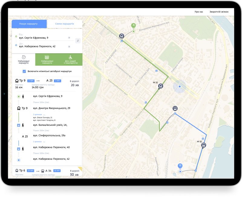
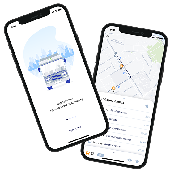
Digital service providing live and offline data on public transport routes and navigation in the cities that includes a mobile application for iOS and Android, a website, and an administration panel for the entire system, powered with AI/ML algorithms. In the app or the website, the user can track the vehicle and see the actual time of arrival of the vehicle on the map, as well as set up AI-predicted routes for transitions. The admin panel allows you to create, edit and disable routes, and create information messages for users to receive as push notifications.

.NET

MongoDB

RabbitMQ

Docker

Identity Server

React Native
React

HTML5

Redis Cache
D-transport is a team of specialists with the creation and implementation of automation processes of the modern city. Their products create a convenient interface between government and residents of transparent and automatic control of construction works. The company's portfolio includes lots of solutions for automating processes in cities, some of them: "United dispatch service", Smart School complex, Safe City complex, and others.
Our team had a goal to create a smart AI-managed algorithm for creating custom routes and built-in A-to-B route search and let users track their movements employing GPS technologies, while allowing for admin users to create optimal routes.
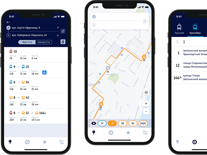
Provide information on local public transport in real-time
Show local public transport fare
Calculate the cheapest or shortest route of passenger location
Send news and route changes to local citizens via Push notifications
Predictions of transport arrivals down to a minute
Predict traffic conditions and create/schedule routes

Lionwood.software Implemented 2 mobile applications for Android and iOS and 2 Web apps for passengers and administrators.
Features that are available to the end-users in Mobile App and Client Web App: